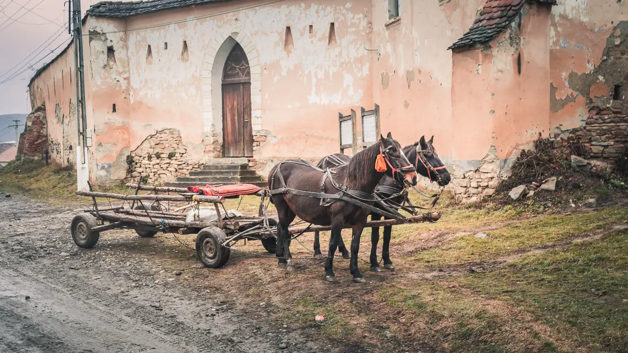
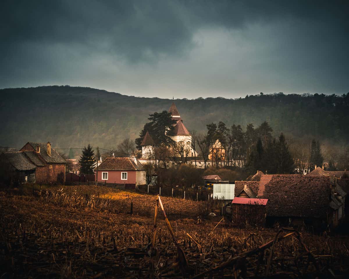
The village of Daia is located in Mureș County, Romania. It is a small Transylvanian village that belongs to the commune of Apold, which is about 8 km away. To reach Daia, you’ll need to drive along a dirt road, adding to its remote charm.
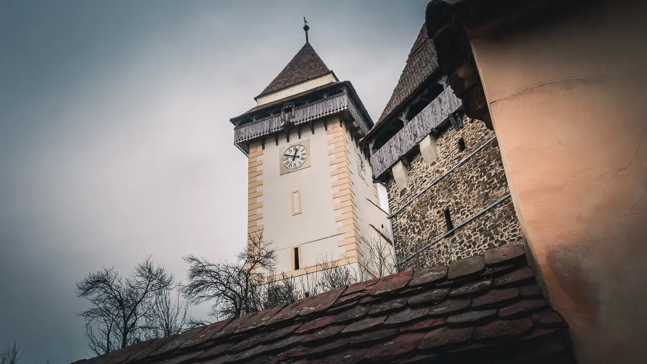
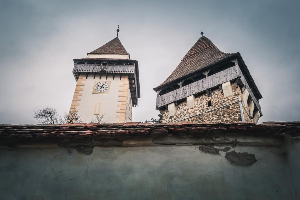
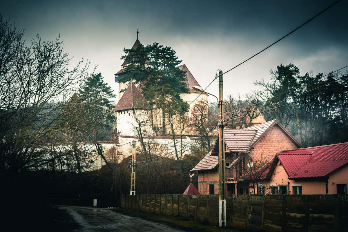
The Evangelical fortified church in Daia
In Daia, you’ll find the historic Evangelical fortified church, built in the 15th century in the Gothic style. What makes this church especially unique is that its tower was constructed outside the fortification walls, separated by a dirt road. This is unusual because, in most fortified churches of Transylvania, all key buildings were enclosed within the fortification walls for protection during enemy attacks.
Unfortunately, the exterior of these historic buildings is in poor condition. Over the years, large cracks have developed in the church tower, affecting its structure and causing it to tilt. Despite its current state, this church remains an architectural gem, and there’s hope that one day it will be restored to its former glory.
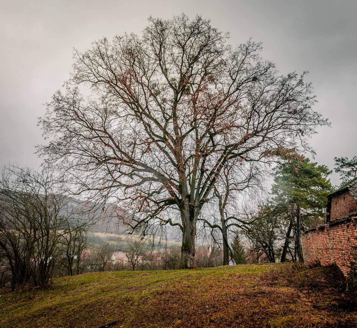
After spending some time near the Evangelical church and exploring the quiet village, it was time to head back to Apold. The weather that day—cold, gray, and rainy—shortened our visit. By the time we decided to leave, it had even started to rain.
Other important places to visit nearby?
About 23 km from Daia is the Sighisoara Medieval Citadel, a place I highly recommend visiting. This well-preserved fortress is full of history and charm, making it a must-see destination in Transylvania.
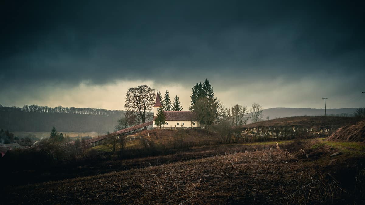
On your way to Sighisoara, you can make a short stop in Apold, the next village along the route. Here, you’ll find the Lutheran Fortified Church, another fascinating example of Transylvanian history and architecture.
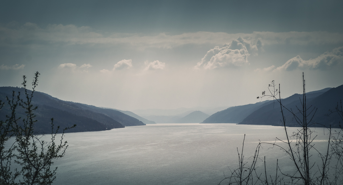
The Danube Gorge, known as Clisura Dunării in Romanian, is a breathtaking region located in the southwestern part of Romania, within the Banat region. This road trip follows the Danube River, which serves as a natural border between Romania and Serbia. Along the way, you will discover stunning landscapes, historic landmarks, and charming villages.
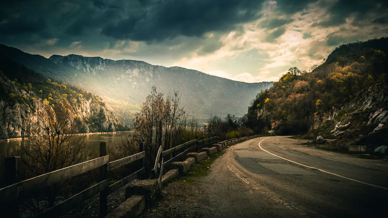
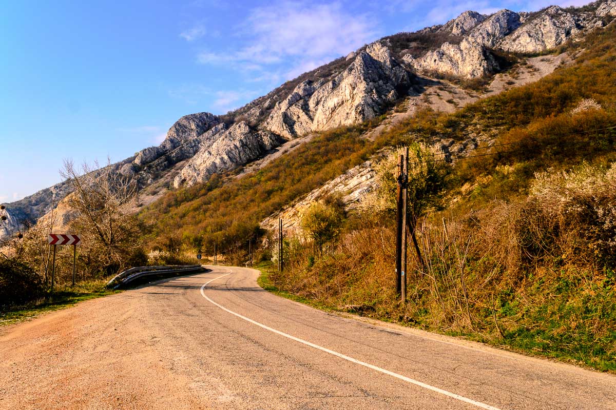
The road from Orșova to the village of Coronini stretches for approximately 95 kilometers, offering one of the most breathtaking drives in Romania. Nearly the entire route runs parallel to the Danube River, providing stunning views of the water and towering cliffs.
This scenic road, officially known as DN57, winds through some of the most picturesque landscapes in the Danube Gorge (Clisura Dunării).
Starting the Journey in Orșova
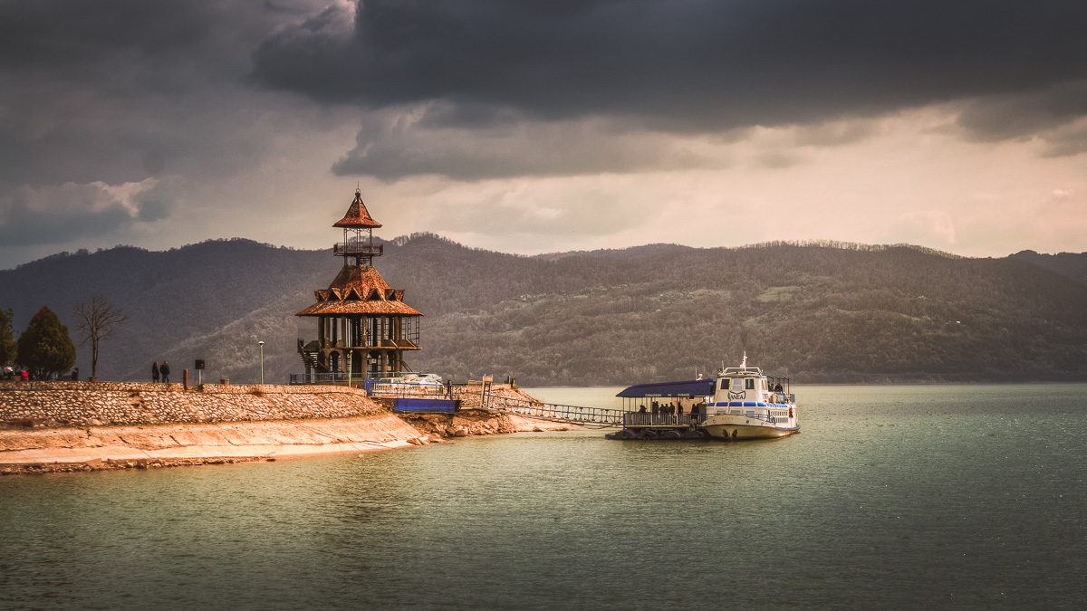
Our journey begins in the port city of Orșova, a picturesque town on the banks of the Danube. Before hitting the road, we took some time to explore Dragalina Park, a peaceful spot offering panoramic views of the city, the port, and the train station. This is a fantastic place for travelers who enjoy photography or simply want to relax while admiring the scenery. We spent nearly an hour here, walking through the park and capturing beautiful moments.
Panoramic view of Orșova.Dragalina Park with a cruise ship waiting for tourists for a ride to the Iron Gates.The mighty Danube near Orsova.
Must-See Landmarks: Decebalus Rex and Mraconia Monastery
A short drive from Orșova brings us to two remarkable landmarks:
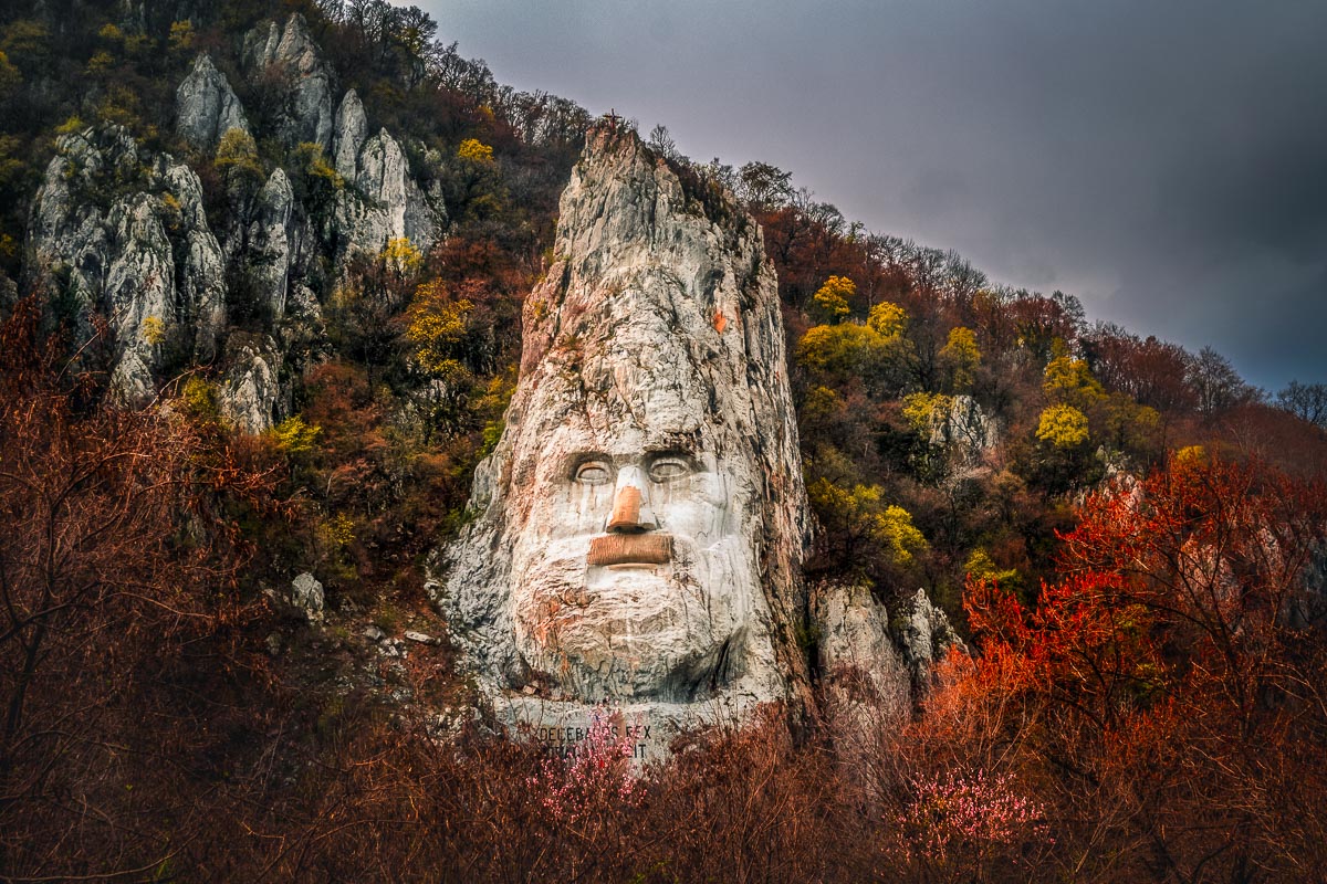
Decebalus Rex Sculpture – This is the tallest rock sculpture in Europe, standing at an impressive 55 meters. It represents Decebalus, the last king of Dacia, who fought against the Roman Empire. This iconic monument is an unmissable sight and a great spot for photos.
Mraconia Monastery – Nestled right on the banks of the Danube, this peaceful monastery offers a stunning view of the river. The combination of the monastery’s beauty and the surrounding natural landscape makes it a perfect stop for history and culture enthusiasts.
Decebalus Rex in the Iron Gates.The Mraconia Monastery and the Danube river.
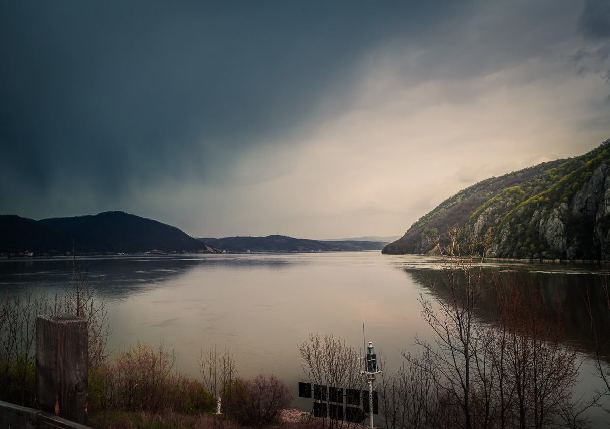
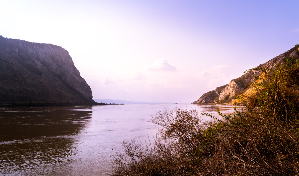
The Kazan Gorge and Dubova Gulf
Continuing our trip, we arrive at the Kazan Gorge, the narrowest section of the Danube in this region. This gorge is divided into two sections: Small Kazan and Great Kazan. The river flows between towering cliffs, creating one of the most spectacular sights along the route.
Right next to the village of Dubova, we find the Dubova Gulf, which sits between the Small and Great Kazan. This is an excellent place to stop and take in the breathtaking scenery of steep cliffs and crystal-clear waters.
Dubova Gulf with the mountains in the background.
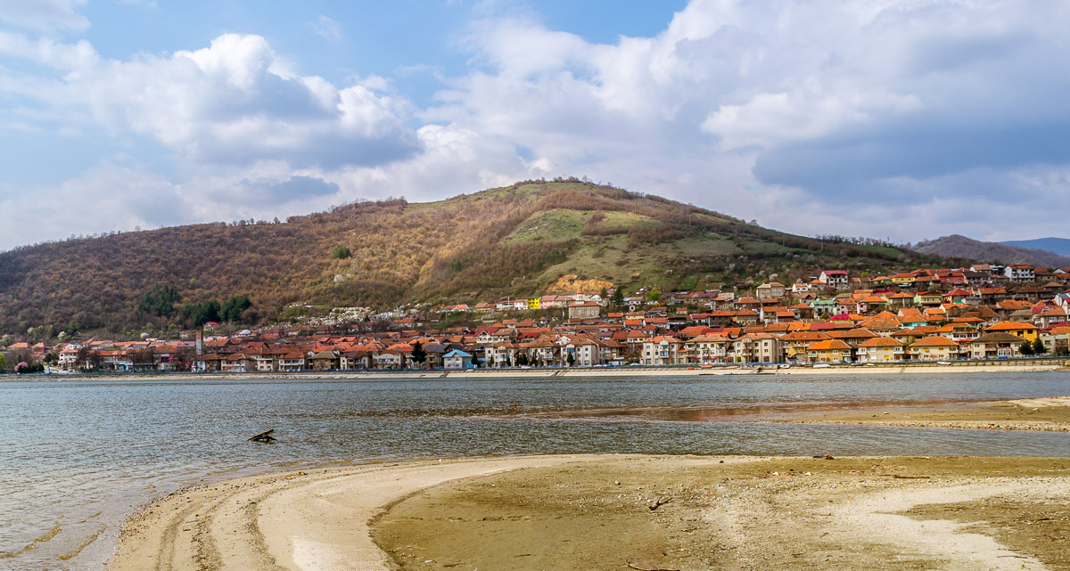
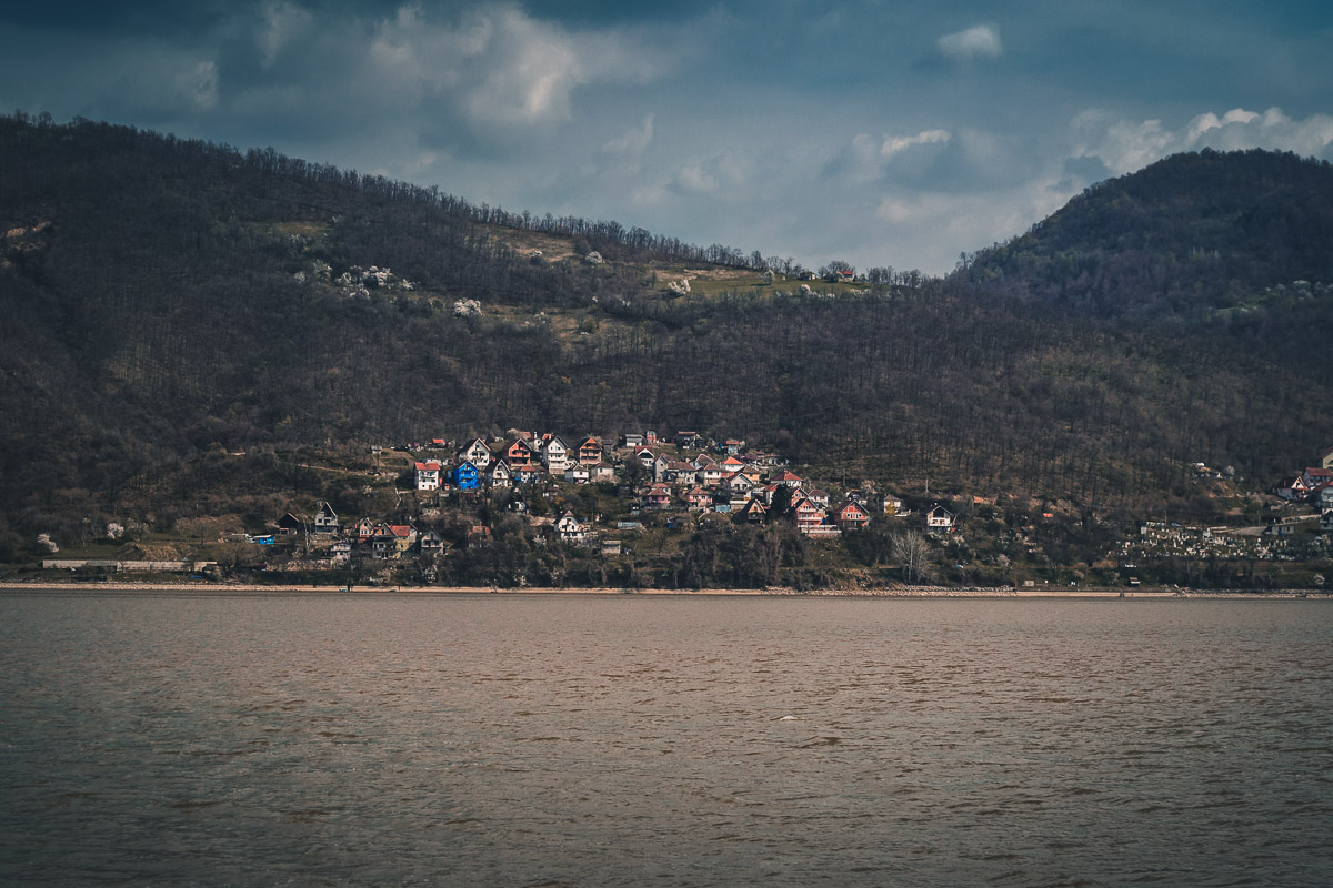
The Danube Widens: Scenic Villages Along the Route
After passing through the Kazan Gorge, the Danube becomes much wider, creating a stunning contrast to the narrow cliffs earlier in the trip. The road continues alongside the river, passing through several charming Romanian villages. This stretch of the journey is more relaxed, with plenty of opportunities to stop, take photos, and admire the peaceful river landscape.
The Danube between Romania and Serbia.Village in Serbia next to the Danube.
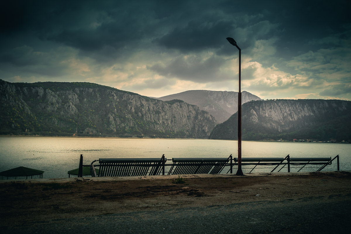
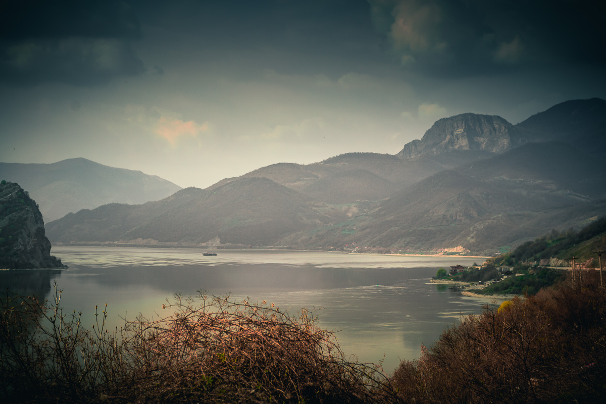
A Short Stop After Svinița
One of the best viewpoints is just past Svinița, a small Romanian village. Here, you can see the towering mountains and dramatic cliffs that rise from the riverbanks on both the Romanian and Serbian sides. It’s a perfect place to take a break and enjoy the view.
Approaching the Final Destination
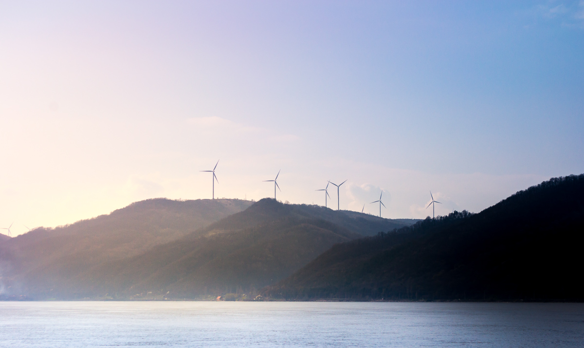
As we near the end of our journey, a few more fascinating sights come into view:
Romanian Wind Farm – Close to Moldova Nouă, we noticed a large wind farm on top of a mountain. These towering wind turbines contrast beautifully with the natural landscape.
Golubac Fortress (Serbia) – Although located across the river in Serbia, this impressive medieval fortress can be seen from the Romanian side. Built right on the banks of the Danube, Golubac Fortress is a striking historical landmark that adds to the magic of the journey.
Large wind farm.The road next to the Danube.The Danube near Coronini.
Our road trip officially ends at Moldova Nouă, where we stop following the Danube and head towards the city of Oravița. However, for those who wish to continue along the river, the road extends to Baziaș, the last Romanian settlement before reaching the Serbian border.
Final Thoughts
This road trip along the Danube Gorge is a perfect mix of natural beauty, history, and culture. Whether you’re a photography enthusiast, a history lover, or simply someone who enjoys scenic drives, this route offers unforgettable experiences. Be sure to bring your camera, take your time exploring, and soak in the breathtaking landscapes of Clisura Dunării!
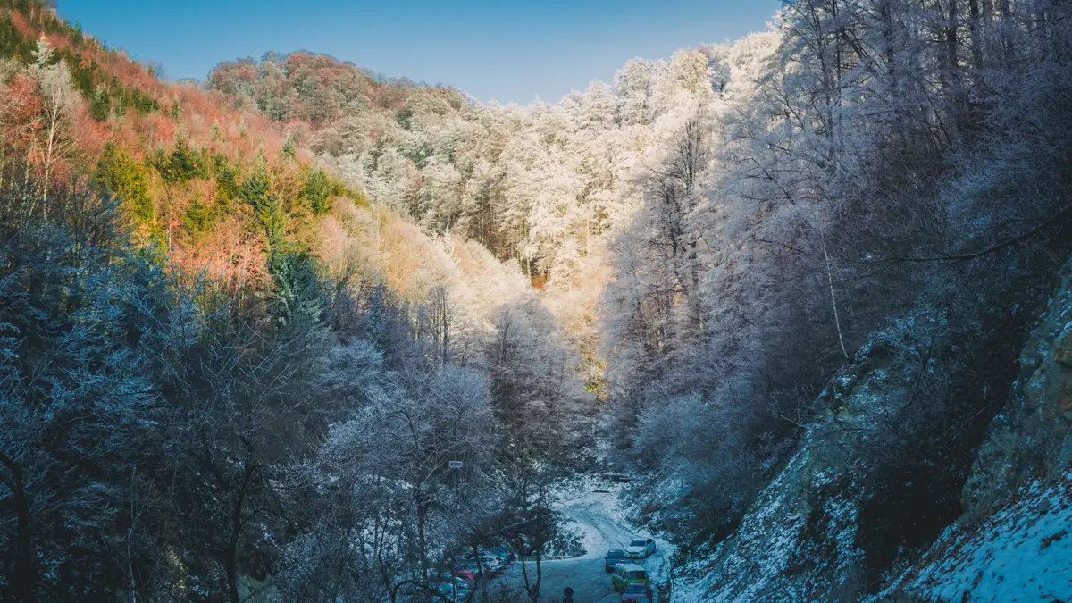
Sarmizegetusa Regia was the capital center of the Dacians during the Roman Empire and it can be found in the Orastie Mountains at an altitude of approximately 1200 meters. From the small Transylvanian city of Orastie, you will have to drive about one hour until you reach the small parking lot located in a small valley close to the former Dacian capital. Despite that there is a paved road up to the ruins, you are not allowed to drive up there with your car.
After you pay for a ticket, you can follow the main path which leads directly to the old sanctuaries.
About Sarmizegetusa Regia
Sarmizegetusa Regia was the capital of the Dacian Kingdom, which flourished from the 1st century BC to the 1st century AD. The Dacians were an ancient people who inhabited the territory that is now Romania. It’s important to mention that it was a major political, military, and religious center for the Dacians. The site is a UNESCO World Heritage Site.
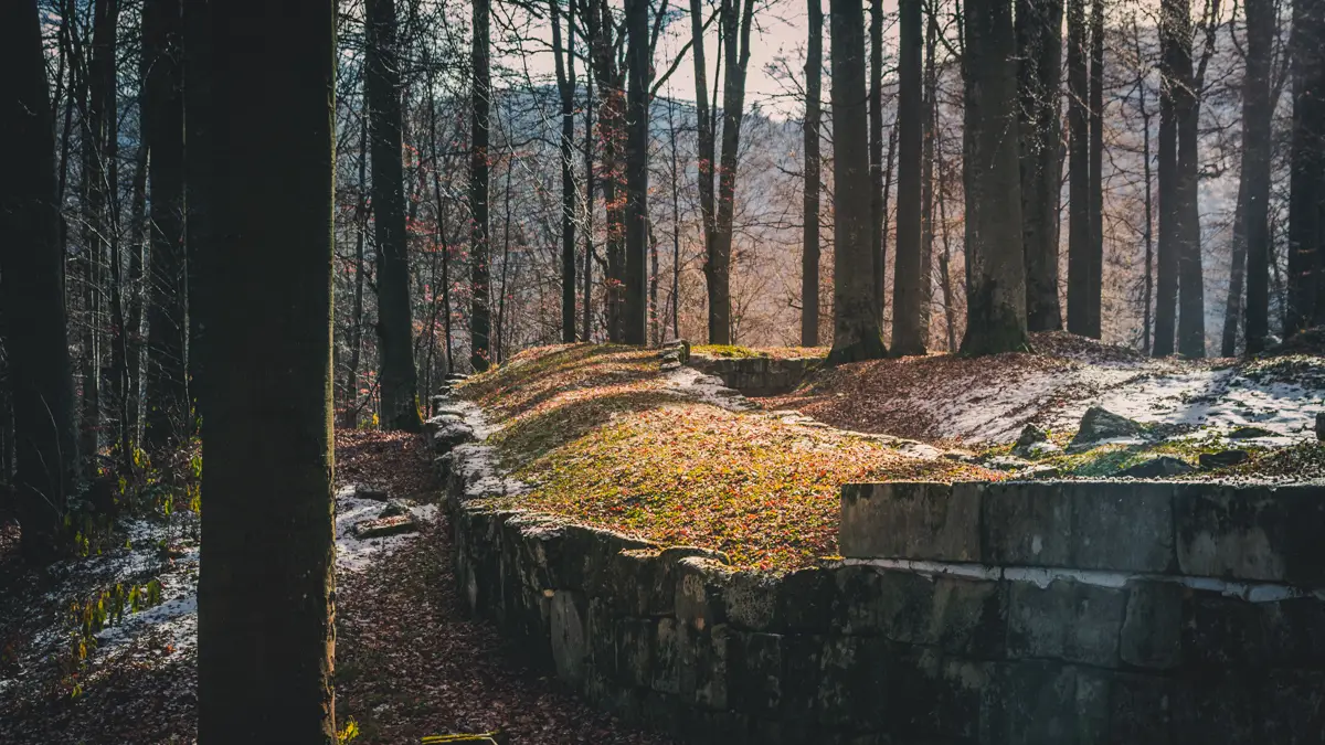
The old defense wall
Not very far from the east gate, the first thing that you will find is some large old stone blocks that were built using the Murus Dacicus (Latin for Dacian Wall) construction method. These old walls used to protect the Dacian capital.
The old fortification wall located near the east gate.
Paved road
If you continue your walk on the main path towards the old sanctuaries, the next interesting thing that will see is the remains of an old paved road built by the Dacians who once lived here.
Paved road built by the Dacians.
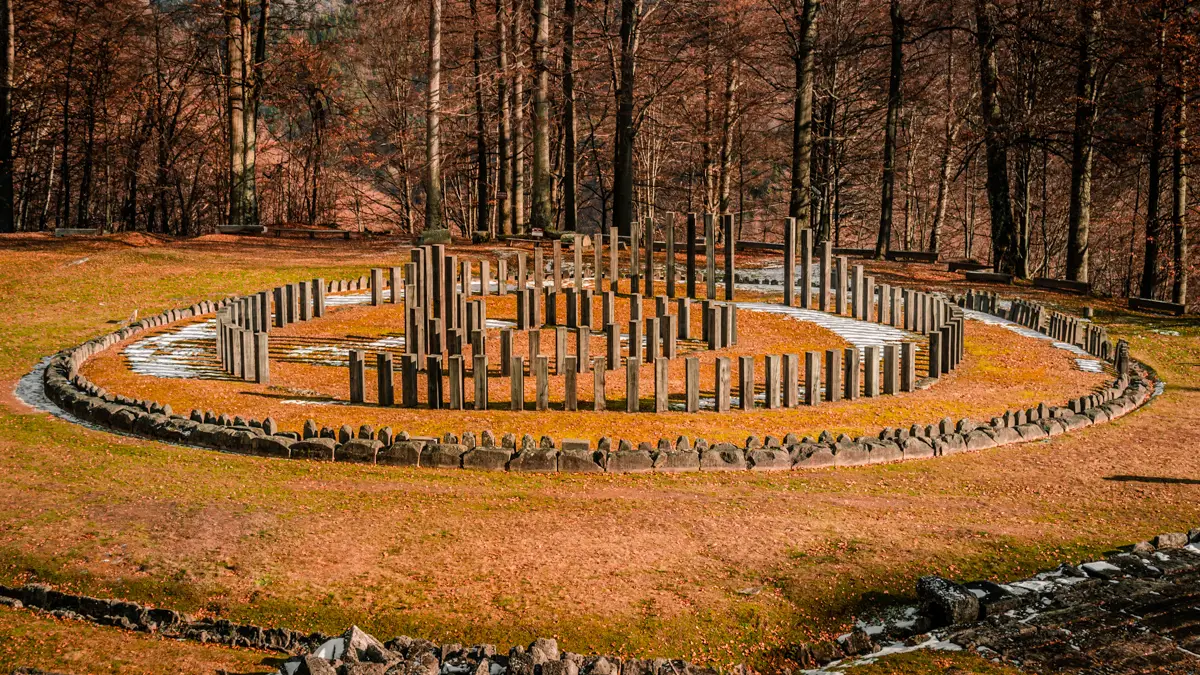
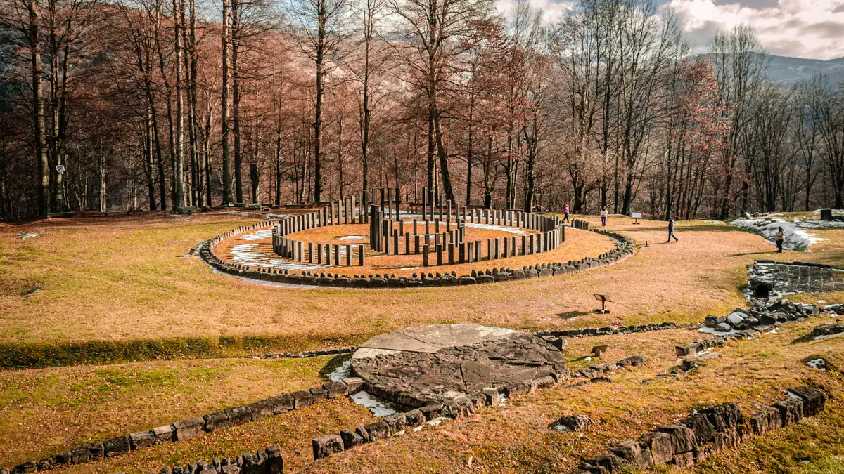
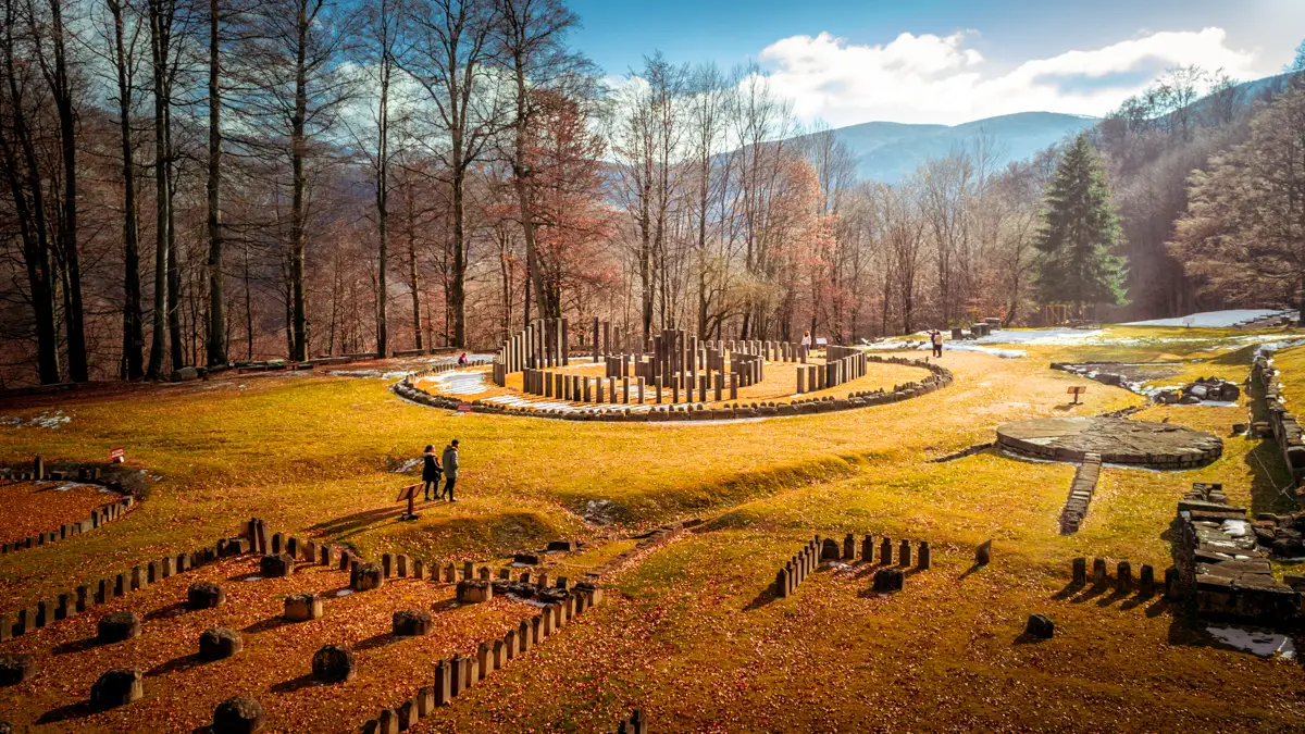
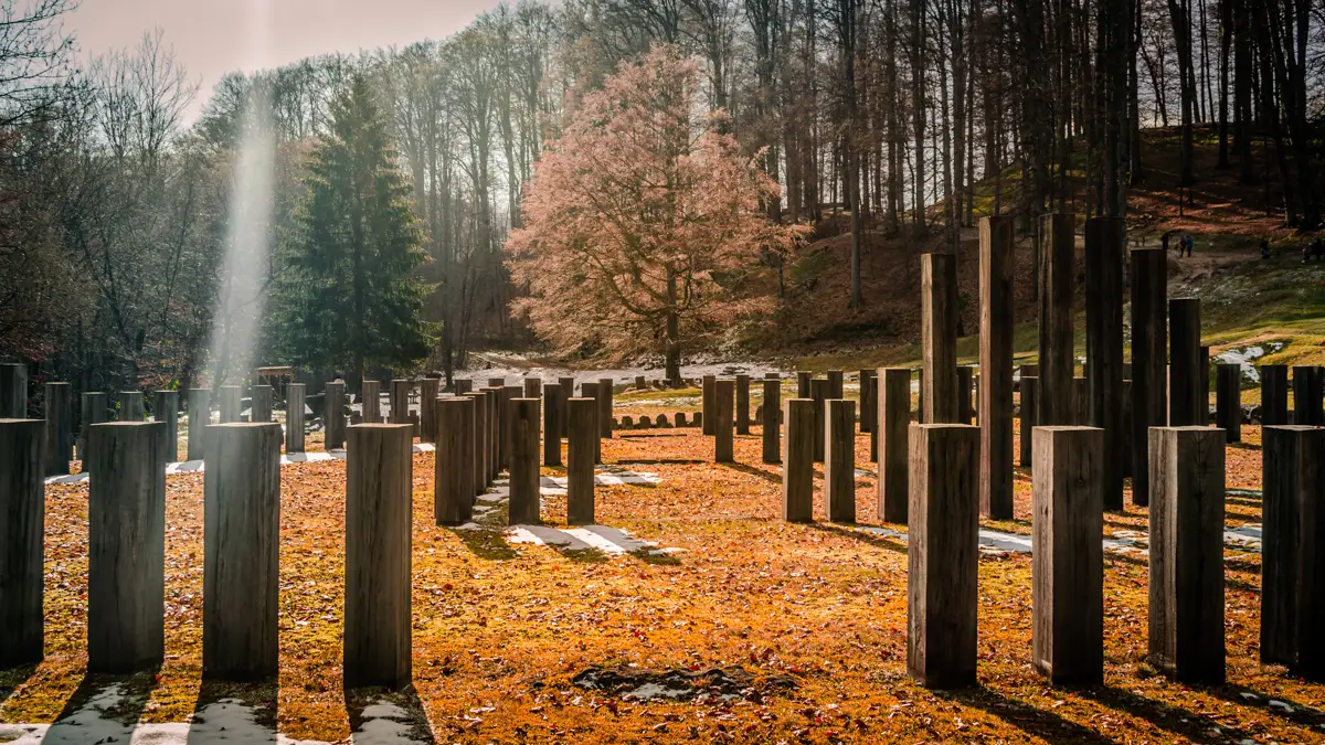
The sanctuaries area
As you make your way down from the fortifications, an enchanting sight unfolds to your right amidst the trees – the limestone sanctuary and the renowned centerpiece of Sarmizegetusa Regia, the great circular sanctuary. This lower section holds sacred significance, housing distinct religious structures that contribute to its spiritual aura.
The limestone sanctuary.The limestone sanctuary as seen from above.Large tree between the sanctuaries.The solar disk and right behind the great circular sanctuary.The great circular sanctuary and other smaller sanctuaries in the foreground.The great circular sanctuaryThe Orastie Mountains with the forest covered by frost.
The scenery next to the parking lot
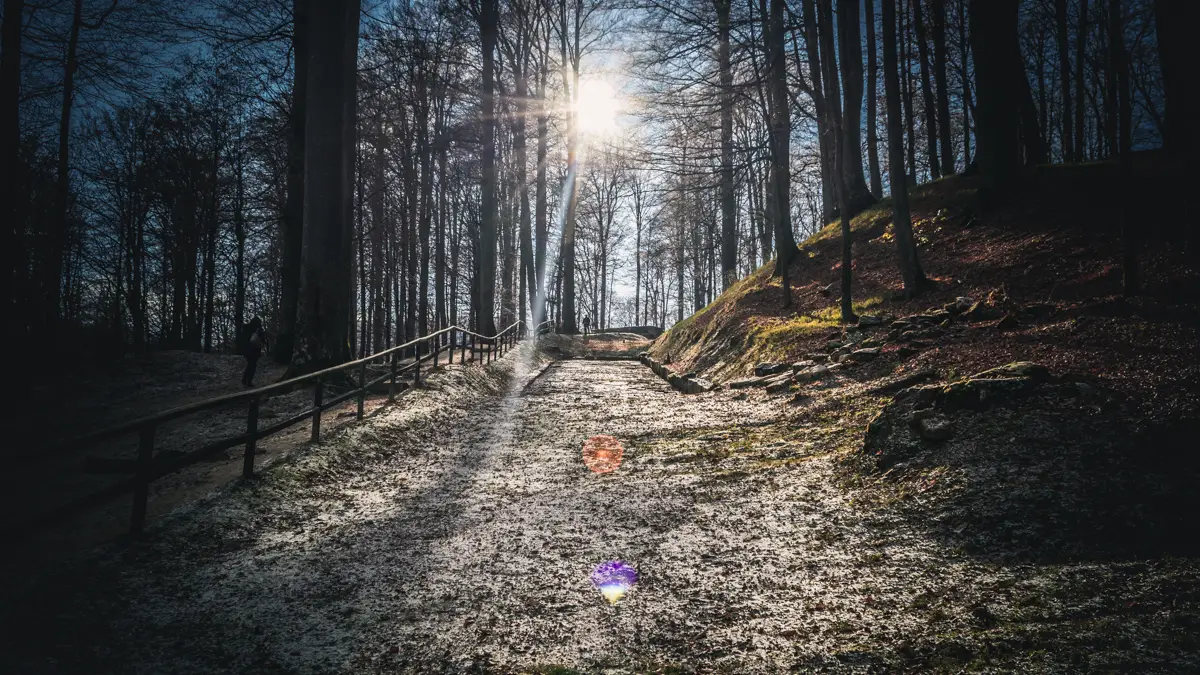
Since I visited this place in early winter, the alpine scenery was amazing, as you can see from the photos below, a large part of the forest was frozen.
The early winter landscape with frost on the trees next to the parking lot.Yellow pine forest near the parking lot.
The Orastie Mountains
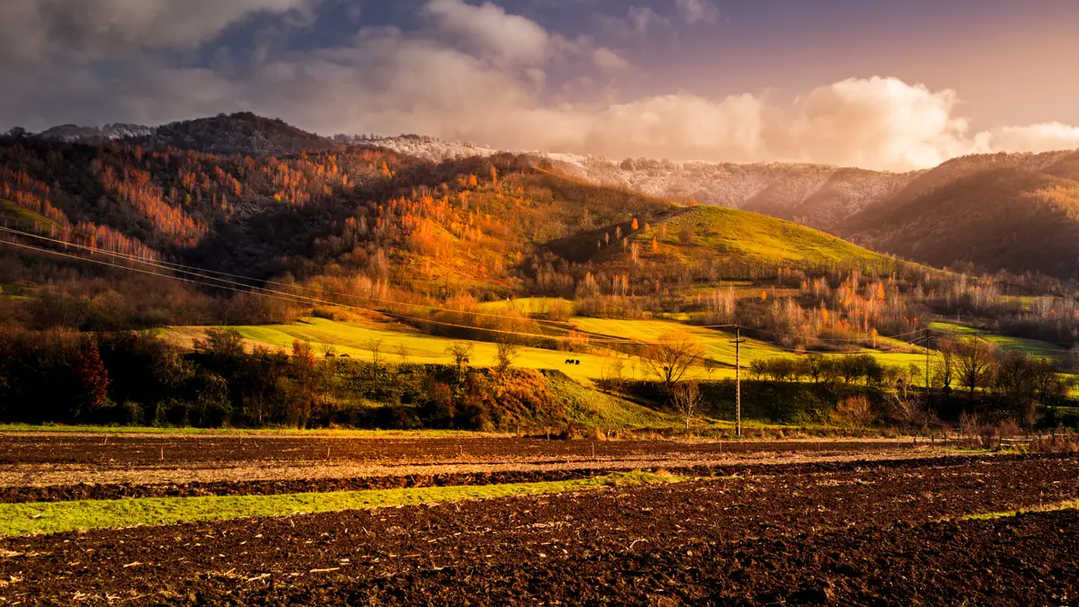
After we drove back to Orastie and since the sun started slowly to set, I decided to capture a landscape photo of the beautiful Orastie Mountains.
The Orastie Mountains next to the village of Costesti.
The Transylvanian commune of Apold is located in Mureș county, Romania. By car, you can actually reach it in almost 20 minutes of driving from the city of Sighișoara. The first thing that you should visit is the Fortified Saxon church. You will find this church almost in the center of the commune right next to the commune’s hall.
Another historical monument in Apold, besides the fortified church, is St. George’s church with its long covered stairway. This smaller church is actually a couple of streets away from the old Fortified Saxon church.
Is there something else to explore in the area?
Not far from the commune of Apold, you will find the village of Daia. Over there you will have the chance to discover another interesting old Saxon church. This one is truly unique compared to the rest of the fortified churches in the historical region of Transylvanian because the church’s tower was not built inside the fortification walls surrounding the church.
Also I have to mention the medieval citadel of Sighisoara which is only about 15 km away from Apold.
After visiting some old fortified churches in the area, like the one form the Transylvanian village of Mălâncrav, on our way back, I’ve decided to capture some photos of the Sighișoara medieval citadel as well.
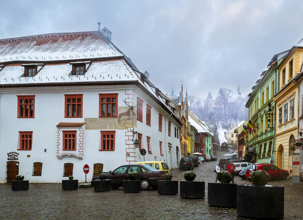
The Clock Tower
The starting point of this photo shoot was at the Clock Tower because this buildings is one of the most important in Sighișoara. That day despite that outside was very cold, in the citadel I saw a lot of tourists wondering around and admiring the old buildings.
Dracula’s house and the Stag House
According to the legends, the building painted in yellow was the birthplace of Vlad the Impaler aka Dracula. If you take a closer look, you can even see in the background of the photo the Church on the Hill.
Not far from Dracula’s birthplace you will find another interesting building which is called the Stag House. The reason for its name is that you will find a stag head right on the corner of the building.
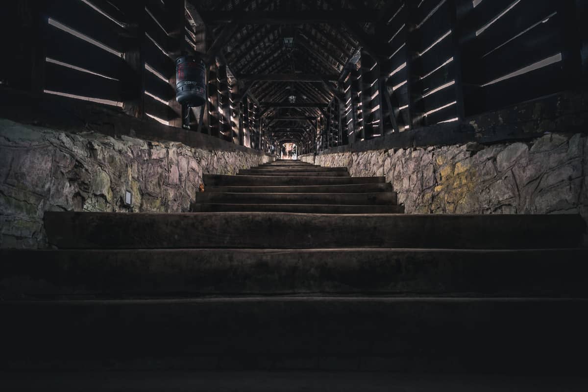
The Covered Stairway in the citadel
The covered stairway was built 1642 and it offered a safe climb to the Lutheran church and to the school especially in the winter season. The stairway is also know as the Scholar’s stairs.
Exploring the upper part of Sighișoara medieval citadel
Once you climb all the stairs of the old Covered Stairway you will end up in the upper part of the medieval citadel. Over there you will find the Church on the Hill which originally was a catholic church and after the 1547 Reform, the majority of the inhabitants of Sighișoara shifted to Lutheranism so after that, the Church on the Hill was turned into a Lutheran church. Near the church is the old Saxon cemetery and the Ropemaker’s tower.
More photos about Sighișoara
If you would like to see more amazing hidden gems in the inhabited medieval citadel then I highly recommend to check out my other post about Sighișoara.
We use cookies on our website to give you the most relevant experience by remembering your preferences and repeat visits. By clicking “Accept All”, you consent to the use of ALL the cookies. However, you may visit "Cookie Settings" to provide a controlled consent.
This website uses cookies to improve your experience while you navigate through the website. Out of these, the cookies that are categorized as necessary are stored on your browser as they are essential for the working of basic functionalities of the website. We also use third-party cookies that help us analyze and understand how you use this website. These cookies will be stored in your browser only with your consent. You also have the option to opt-out of these cookies. But opting out of some of these cookies may affect your browsing experience.
Necessary cookies are absolutely essential for the website to function properly. These cookies ensure basic functionalities and security features of the website, anonymously.
Cookie
Duration
Description
cookielawinfo-checkbox-analytics
11 months
This cookie is set by GDPR Cookie Consent plugin. The cookie is used to store the user consent for the cookies in the category "Analytics".
cookielawinfo-checkbox-functional
11 months
The cookie is set by GDPR cookie consent to record the user consent for the cookies in the category "Functional".
cookielawinfo-checkbox-necessary
11 months
This cookie is set by GDPR Cookie Consent plugin. The cookies is used to store the user consent for the cookies in the category "Necessary".
cookielawinfo-checkbox-others
11 months
This cookie is set by GDPR Cookie Consent plugin. The cookie is used to store the user consent for the cookies in the category "Other.
cookielawinfo-checkbox-performance
11 months
This cookie is set by GDPR Cookie Consent plugin. The cookie is used to store the user consent for the cookies in the category "Performance".
viewed_cookie_policy
11 months
The cookie is set by the GDPR Cookie Consent plugin and is used to store whether or not user has consented to the use of cookies. It does not store any personal data.
Functional cookies help to perform certain functionalities like sharing the content of the website on social media platforms, collect feedbacks, and other third-party features.
Performance cookies are used to understand and analyze the key performance indexes of the website which helps in delivering a better user experience for the visitors.
Analytical cookies are used to understand how visitors interact with the website. These cookies help provide information on metrics the number of visitors, bounce rate, traffic source, etc.
Advertisement cookies are used to provide visitors with relevant ads and marketing campaigns. These cookies track visitors across websites and collect information to provide customized ads.